
A specialist examining a simulation model of a city’s flood zones, pointing to projections on a large digital map
City, city infrastructure, city planning, city simulation, climate adaptation, data analysis, digital map, digital technology, digital tools, disaster management, disaster preparedness, disaster prevention, environmental monitoring, environmental planning, environmental science, examining, Flood, flood analysis, flood management, flood projection, flood zone study, flood zones, Geography, GIS, hydrology, map analysis, mapping, Model, pointing, Professional, Professional work, projections, Risk Assessment, simulation, simulation model, spatial analysis, specialist, sustainable planning, Technology, urban design, Urban development, urban planning, urban resilience, water management
Need Help? Tailor Your Visuals!
Bring your creative vision to life with our expert image customization services. Utilizing cutting-edge AI technology, we adapt each visual element to perfectly reflect your brand’s style and message. Visit the Customization page for details.
If you notice anything that seems off in the customized image or if it doesn’t meet your expectations, please use our Content Report page to let us know.
A professional analyzing a scale model of a city, pointing out proposed parks and transportation routes to colleagues in a bright meeting room

A steel skyscraper rising high into the clouds, symbolizing the strength and durability of metal structures
A small business expanding into a larger operation, visualized by a small shop transforming into a skyscraper

Pedestrian walkway lined with trees and shops, promoting walkability and urban livability, shows the human-centered design of urban spaces

A weather balloon ascending into the atmosphere, gathering data to improve forecasting and research
A sound wave transforming into a city skyline, illustrating how music streaming shapes urban soundscapes
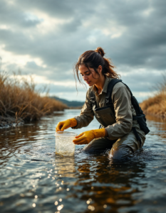
A scientist wading through a shallow river, taking water samples with a collection kit while monitoring nearby currents and sediment

A professional inspecting treatment tanks at a large facility, wearing safety gear and holding a clipboard filled with blueprints
A professional at a computer station analyzing data from field sensors tracking air quality and carbon emissions
A futuristic cityscape with buildings made of shimmering metal alloys, reflecting the advancements in material science
A futuristic cityscape powered by renewable energy, symbolizing the transition away from fossil fuels

Two scientists in white lab coats working in a laboratory featuring various scientific equipment alongside instruments

Students wearing VR headsets to explore ancient ruins or distant planets
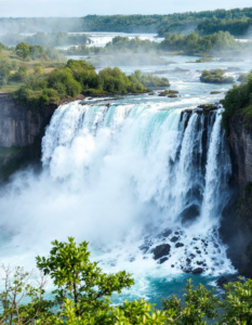
Niagara Falls, a powerful waterfall cascading down a cliff face

Modern skyscrapers reflecting the sunset, emphasizes the sleek lines and innovative designs of contemporary urban architecture

A worker laying soil and planting greenery on a rooftop, with a city skyline visible in the background

A worker adjusting water levels and monitoring fish health in a greenhouse filled with vertical gardens and fish tanks
A technician inspecting water levels at a reservoir, with gauges, notebooks, and a calm lake reflecting the sky

A tech professional working in a dimly lit office, surrounded by multiple screens showing code and cybersecurity alerts
A specialist overseeing tanks filled with young fish in a coastal facility, checking water quality and feeding schedules
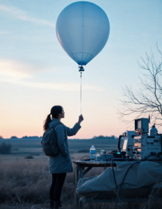
A specialist launching a weather balloon into a bright sky, surrounded by instruments and data logging equipment